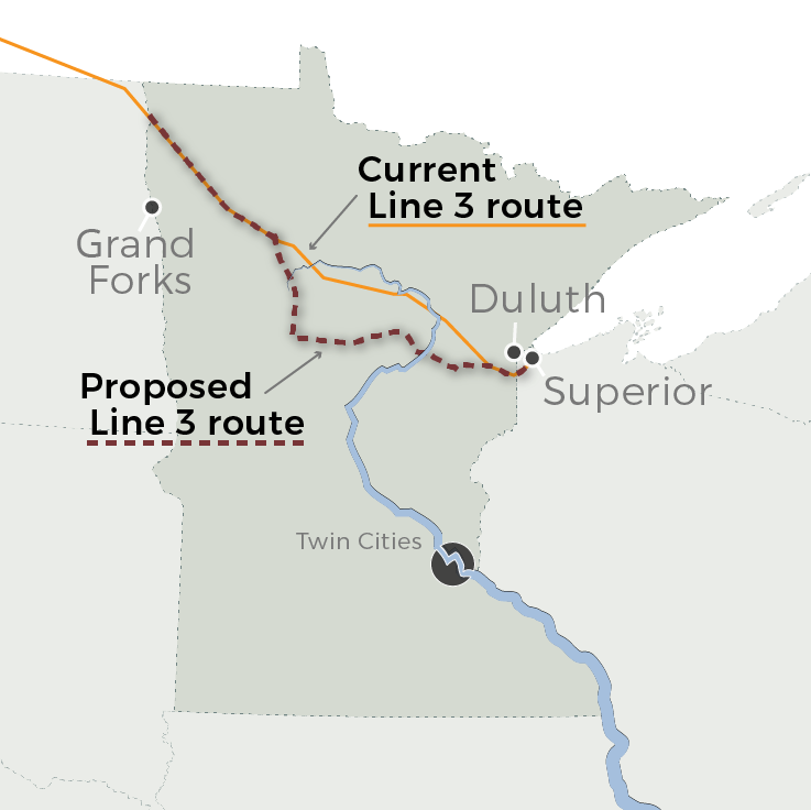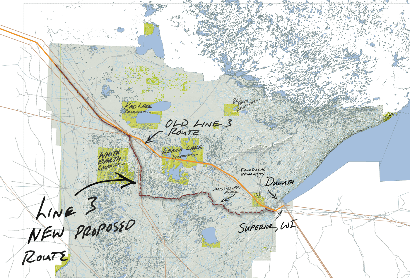
Minnesota's Line 3 oil pipeline proposal: The basics
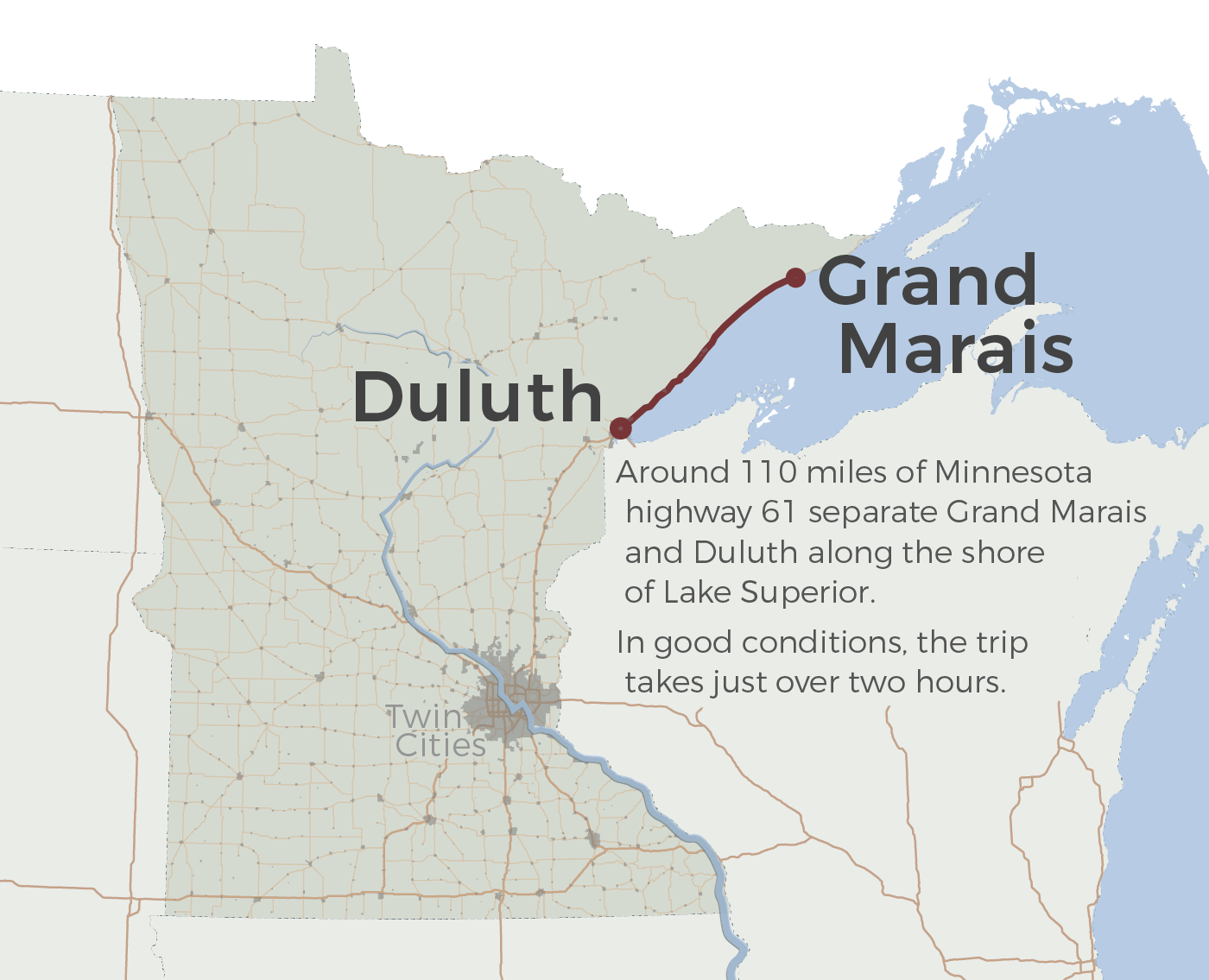
The map created from various data sources. GIS data from State of Minnesota, petro-chemical pipeline data from U.S. DoE and MN Dept. of Commerce, and other sources - MPR News
Tiled basemap crafted for the Storymap.js embed. Custom created icons and crafed basemap that includes GIS driven county and municipal borders, geographic features and roads along the route of Highway 1 across northern Minnesota - MPR News
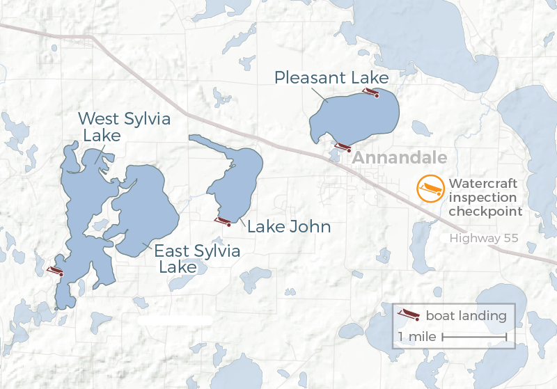 'We don't close our lakes': In battle against aquatic invaders, it's protection vs. access
GIS data, MN DNR data, database of infested lakes - MPR News
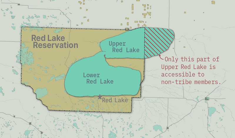 Only a small portion of Upper Red Lake is accessible to non-tribal members
GIS data for treaty boundaries, water bodies and tribal access areas. - MPR News
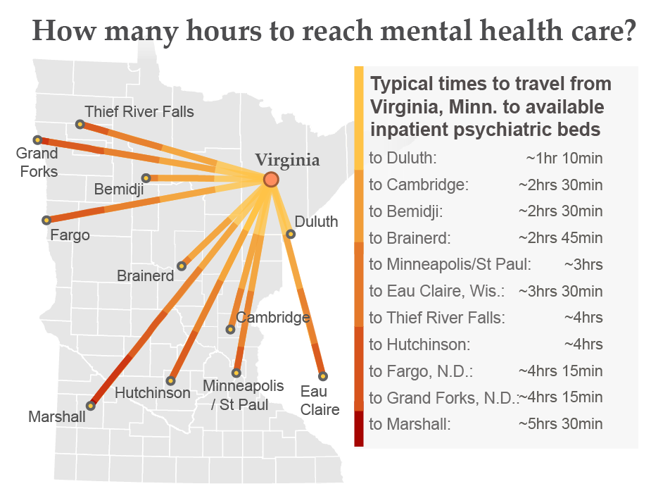 Iron Range mobile team offers mental health help to go
GIS data, travel time data from Cook Hospital - MPR News
 Rural hospitals retreat from delivering babies; small towns pay the price
GIS road, land and municipality data, travel time data - MPR News
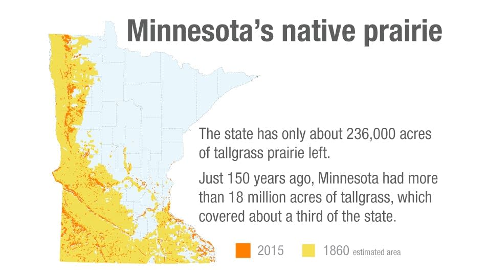 Preserved parcels offer glimpse of Minnesota gone by
GIS data interpreted into flat map. Showing current and historic natural prairie areas across Minnesota. - MPR News
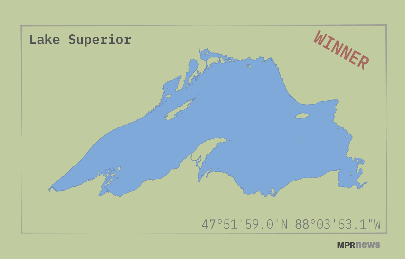
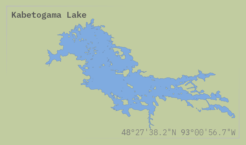 •The winner of our most-loved Minnesota lake contest is ... Lake Superior
•Vote for your favorite lake
MN DNR GIS data - MPR News
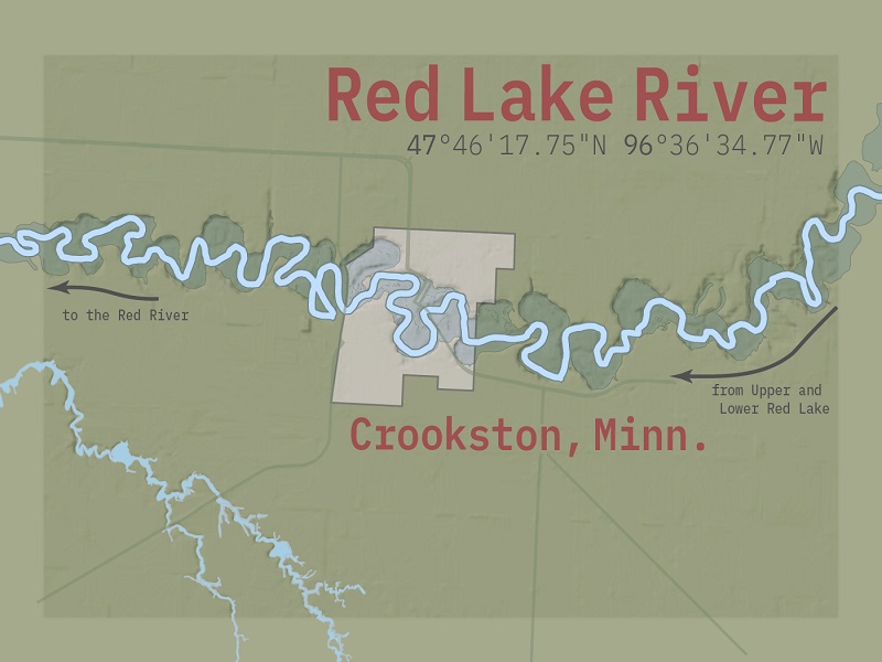 Red Lake River flowing through Crookston, Minn.
GIS data for hillshade and elevation with flood plain and water body data. - MPR News
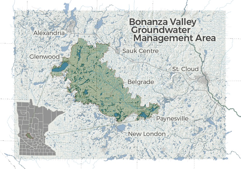 In Minnesota's Bonanza Valley, DNR gauges water use as farmers watch
GIS terrain, road, hillshade and water body data, combined with MN DNR region data.
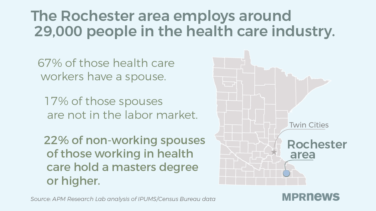 As Rochester grows, 'trailing spouses' still struggle to find work
GIS data, APM Research Lab data, U.S. Census data - MPR News
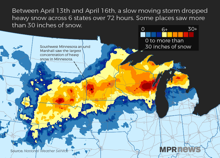 Snowstorm for social media
National Weather Service precipitation data with GIS map data. - MPR News
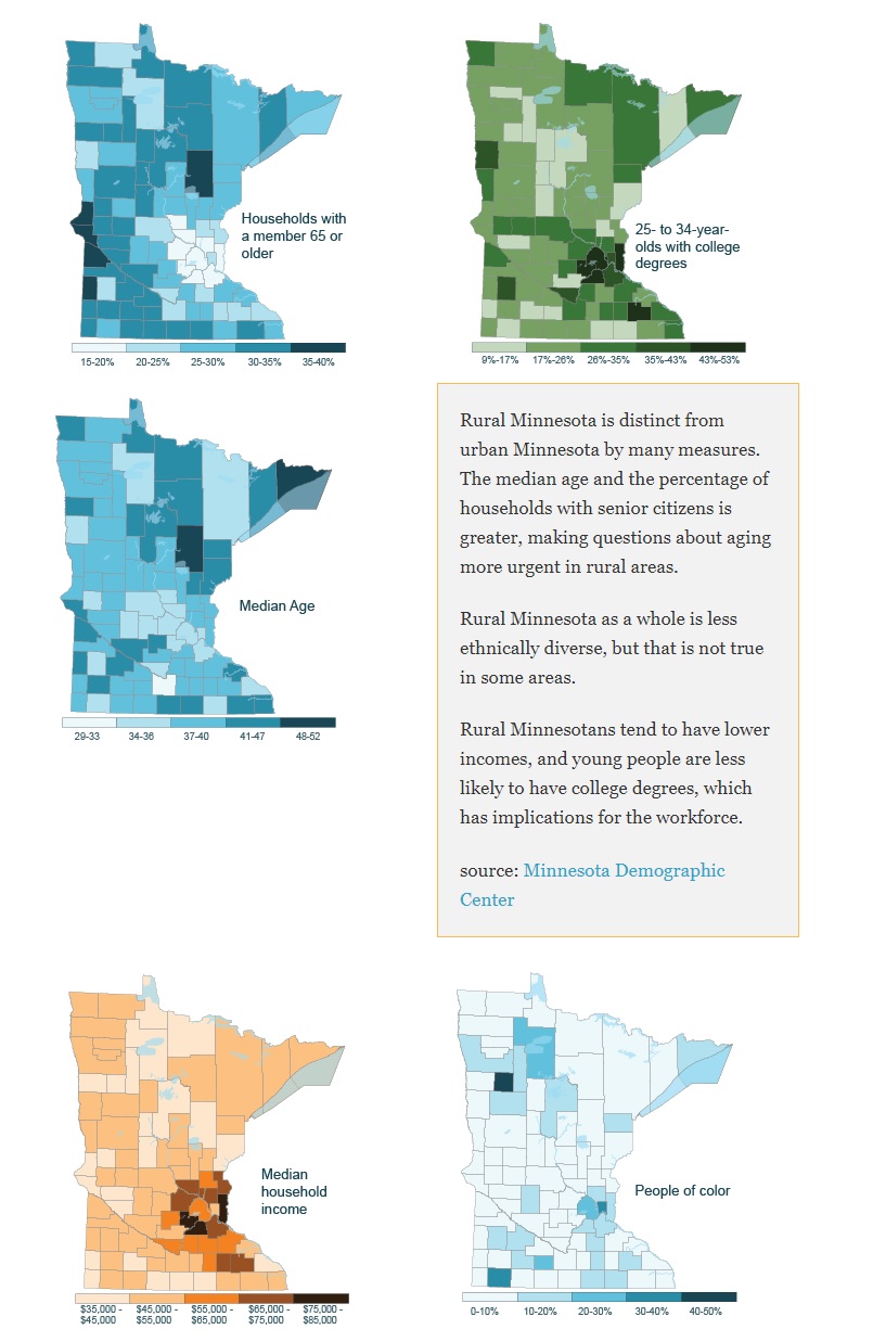 Rural MN demographics, from the Fighting for an American Countryside project
Minnesota Demographic Center data and GIS - MPR News

